Frank Barney and Martin Conservation Areas
Overview
Pocket parks with trails rising through wooded slopes. Frank Barney has Roxbury Conglomerate ledges and benches. Martin has old stone walls.
Size: Frank Barney: 1.6 acres; Martin: 0.6 acres Longest Walk: 0.5 miles Acquired: Frank Barney: 1975 and 1997; Martin: 1967
A Highly Unofficial Route on Connections to the Upper Falls Greenway
Upper Falls Loop Trail
Maps
Locator Map and Driving Directions
Other maps and aerial photos:
Bing Maps bird’s-eye view: Martin
Bing Maps bird’s-eye view: Barney
Nearby: Upper Falls Greenway
Trail Map
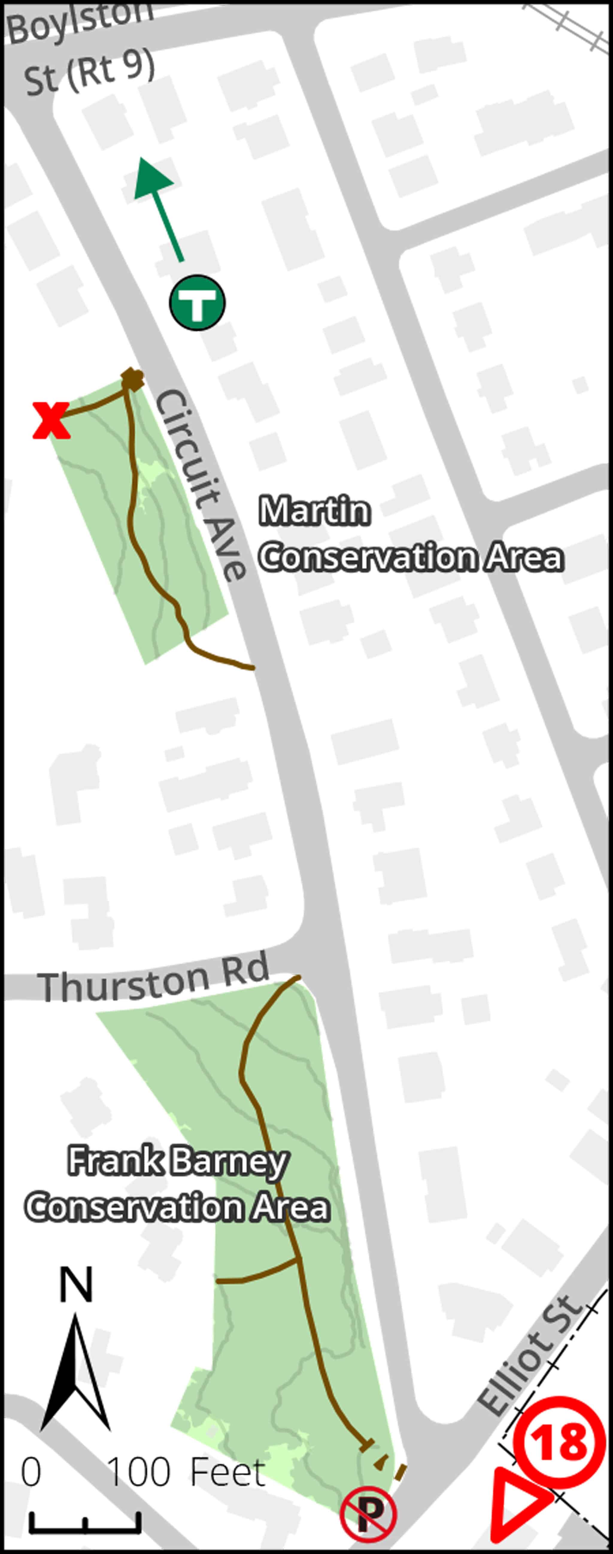
Click map for larger image •
Owner & Administrator Websites
Photo Gallery


First three photos shown here. Click a photo to view the complete slideshow or click here to browse the complete gallery.
Features
Biking: Prohibited, Conservation Area, Dogs On Leash, Geologic Features, MBTA Green Line
Additional Information
Newton Assessor’s Map ID: 51019 0005 and other parcels
Each year since 2021, Upper Falls residents (and sisters) Julie and Lisa Leavitt have created an art installation in the Martin Conservation Area called the Martin Poetry Path. The path features poems written by Newton poets, and rocks decorated by Mason Rice 2nd graders.
Report a Problem
Report a Problem in a Newton Conservation Area