Oakdale Woods
Overview
The Oakdale Woods are typical of the many small open space parcels in the southern part of the city that were developed after World War II. This small space has been used by neighborhood children for winter sledding, acorn fights, and informal camping for many generations and was left undeveloped due to its geological features, including a substantial deposit of Roxbury Puddingstone and glacial boulders, as well as a steep cliff running the length of the woods.

Old maps going back to at least 1917 show a paper street continuing Oakdale Road through the woods. The area was subdivided into 10 house lots. However, the road was never built, and the land never developed. Stearns Brook runs through the woods in this pocket park.
Size: 3 acres Longest Walk: 0.3 miles Acquired: 1979
Maps
Locator Map and Driving Directions
Trail Map
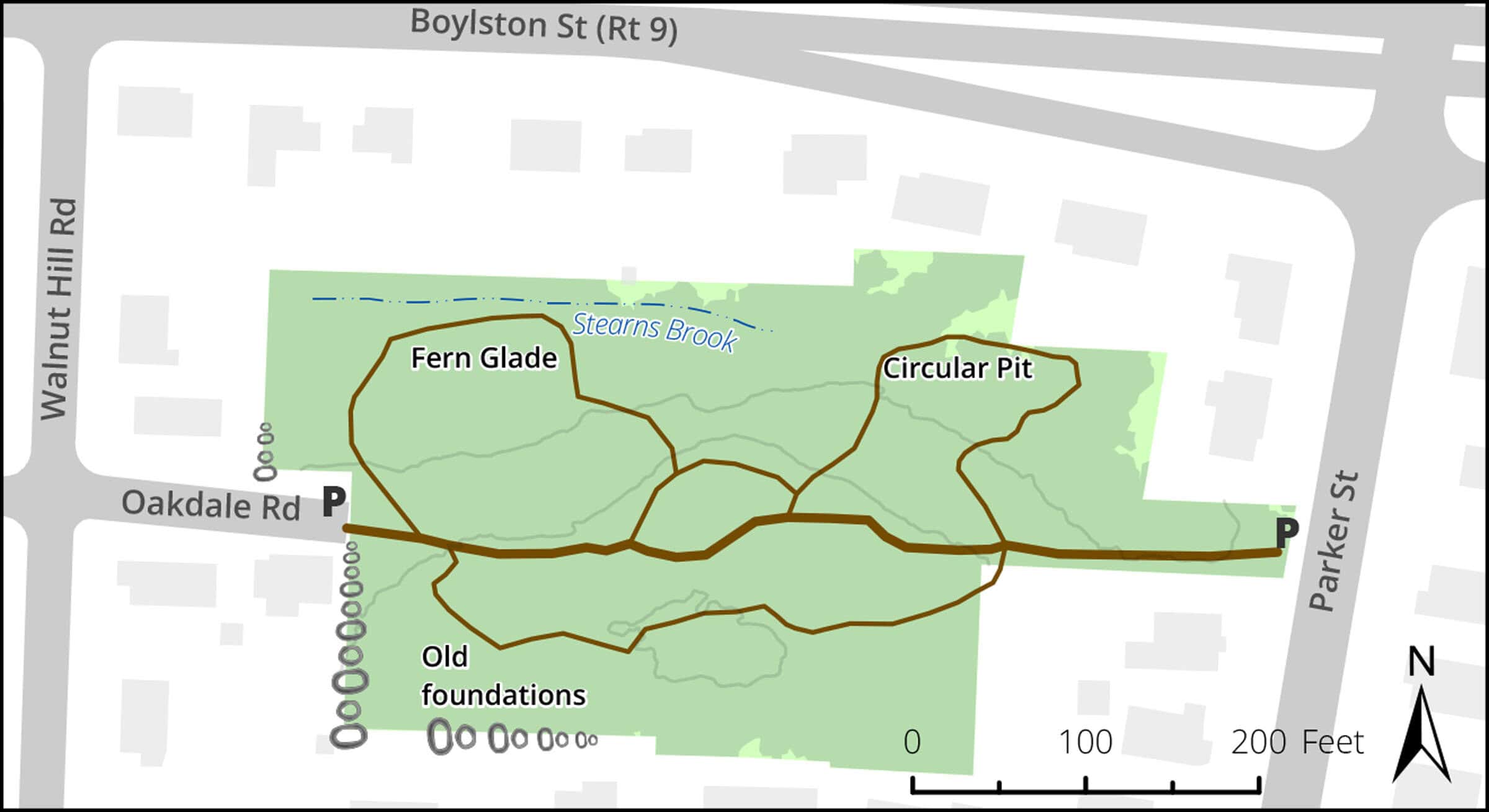
Click map for larger image •
Owner & Administrator Websites
Photo Gallery


First three photos shown here. Click a photo to view the complete slideshow or click here to browse the complete gallery.
Features
Biking: Prohibited, Conservation Area, Dogs On Leash