
Chestnut Hill Reservation
Overview
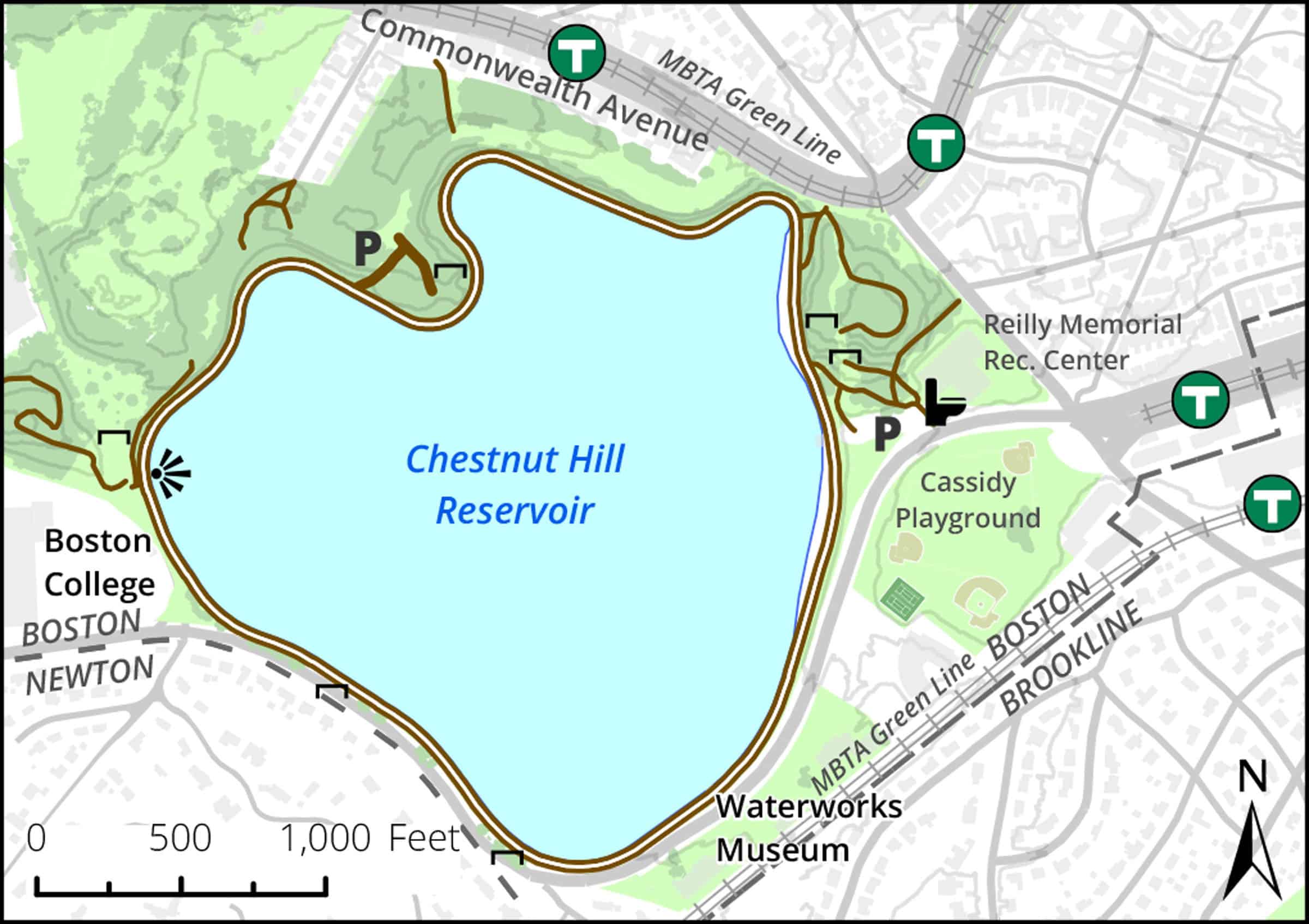
A popular 1.5-mile circular path with pleasant vistas of Back Bay skyscrapers, the Reservation was designed by Frederick Law Olmsted’s son and constructed in the late 1860s to give Boston clean drinking water and a rural park.
Still largely intact, the waterworks with its three gatehouses at water’s edge and three majestic pump houses on Beacon Street is considered a masterpiece of 19th century engineering and landscape design. Both Cochituate and Sudbury Aqueducts are still connected to the Reservoir, but the system has been disabled.
Today the paths around the Reservoir and through the woods are open for public use, where local birders have found good vantage points for the somewhat frequent viewing of rarities in migration. The DCR recreation center offers seasonal swimming and ice skating.
Size: 120 acres including 88-acre reservoir and surrounding parkland Longest Walk: 1.5 miles Acquired: 1867
Maps
Locator Map and Driving Directions
Located in the Brighton neighborhood of Boston
Get here by MBTA:
A 0.3 mile walk from Reservoir Green Line station
Other maps and aerial photos:
Trail Map
Click map for larger image
Owner & Administrator Websites
Photo Gallery


First three photos shown here. Click a photo to view the complete slideshow or click here to browse the complete gallery.
History
1867-70
Reservoir built consisting of two large basins separated by causeway (now Chestnut Hill Road).
1880-90s
Pumping stations constructed
1950
Upper basin filled in and land sold to Boston College to be athletic fields
1970s
Lower basin and pumping stations taken off line
2005
Several old pumping buildings converted to condominium residences as part of the Waterworks development
2010
Waterworks Museum opens in the former High Service Pump Station building.
Features
Accessible Trails, Biking, Birding, Conservation Area, Cross Country Skiing, Historic Site, MBTA Green Line, Pond, Scenic View, Sports Fields
Additional Information
The Metropolitan Waterworks Museum: Big Buildings, Big Machines, Big Stories (an 11-minute video by Ellie Goldberg and Laura McCarthy Johnson in association with NewTV)
Brighton Allston Historical Society
Report a Problem