Newton Commonwealth Golf Course
Overview
This beautiful property was saved from mass development by a creative arrangement. Originally part of a private golf course, the land on its edges was sold for condos, funding the purchase of the golf course. The course itself, now a public course, is situated in a valley, and the steep hillside on the Eliot Memorial end provides a scenic view. The Cochituate Aqueduct runs underground through the south end.
The area is enjoyed for cross-country skiing and sledding in the winter.
Size: 71 acres Longest Walk: 1.4 miles (open for walking only when course is closed for the season) Acquired: 1981
Maps
Locator Map and Driving Directions
Other maps and aerial photos:
Nearby:
Trail Map
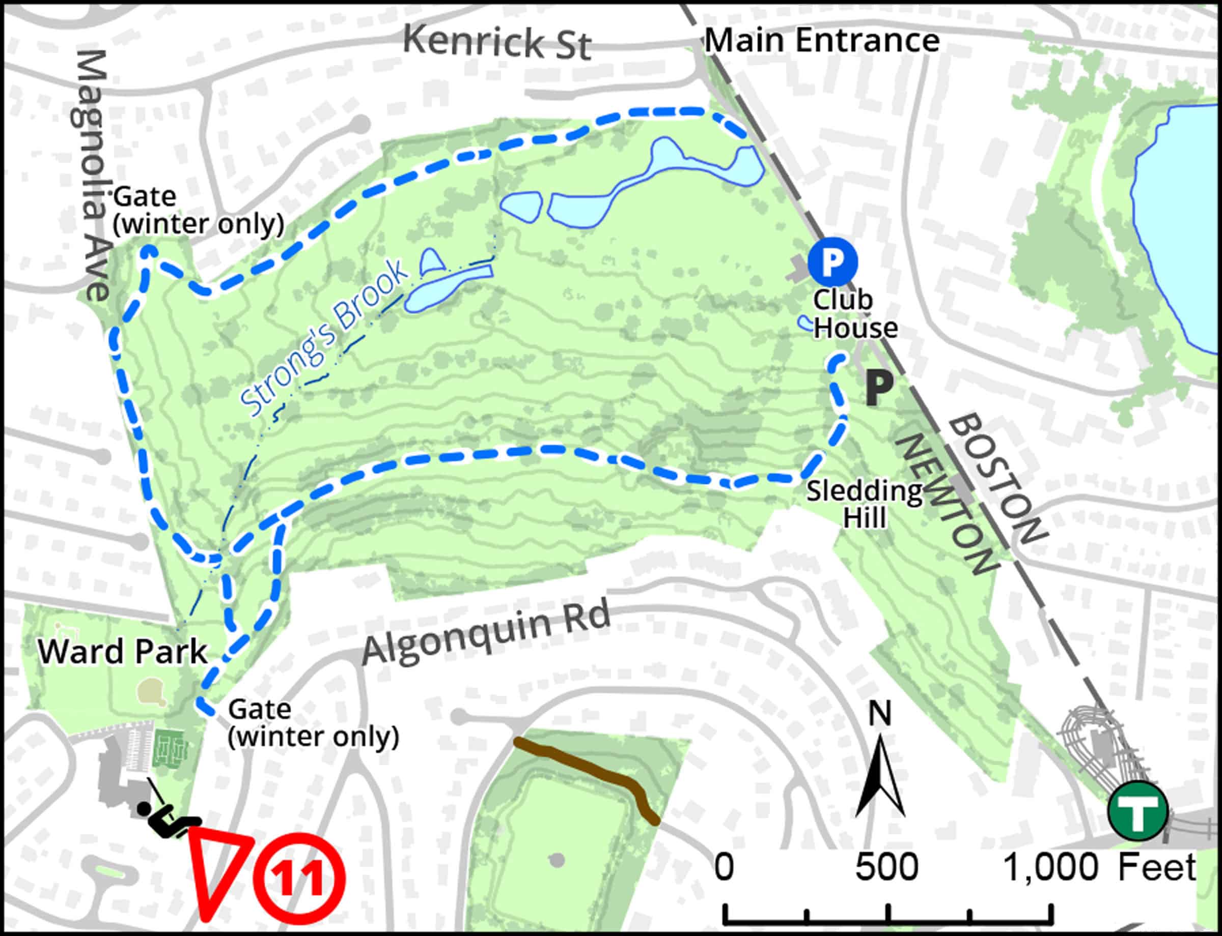
Click map for larger image •
Owner & Administrator Websites
Photo Gallery


First three photos shown here. Click a photo to view the complete slideshow or click here to browse the complete gallery.
History
1897
The Commonwealth Club developed a nine-hole golf course as a spin-off of the old Allston Golf Club.
1920
The 18-hole course was redesigned by legendary golf course architect Donald Ross.
1981
The property was purchased by the City of Newton from the Chestnut Hill Country Club through a federal grant to enable access to the land by all Newton residents.
2009
A conservation restriction granted to the Newton Conservators by the City of Newton permanently protects the property from development if it is no longer used as a golf course.
Features
Biking: Prohibited, Dogs On Leash, River/Lake/Pond, Scenic View, Toilet Facilities, Winter Sports
Additional Information
Newton Assessor’s Map ID: 72039 0016 and other parcels
![]()