Heartbreak Hill Park
Overview
The former MWRA “Waban Hill Reservoir” is located on a hill overlooking Boston College (and not in the Waban neighborhood). Newton acquired the property in 2015 and turned it into a park which includes an accessible trail around the perimeter of the reservoir, as well as a small grass playing area.
Size: 5 acres Longest Walk: 0.4 miles Acquired: 2015
Maps
Locator Map and Driving Directions
Get here by MBTA: Directions from end of Green Line: B Train
Other maps and aerial photos:
Nearby: Newton Commonwealth Golf Course
Trail Map
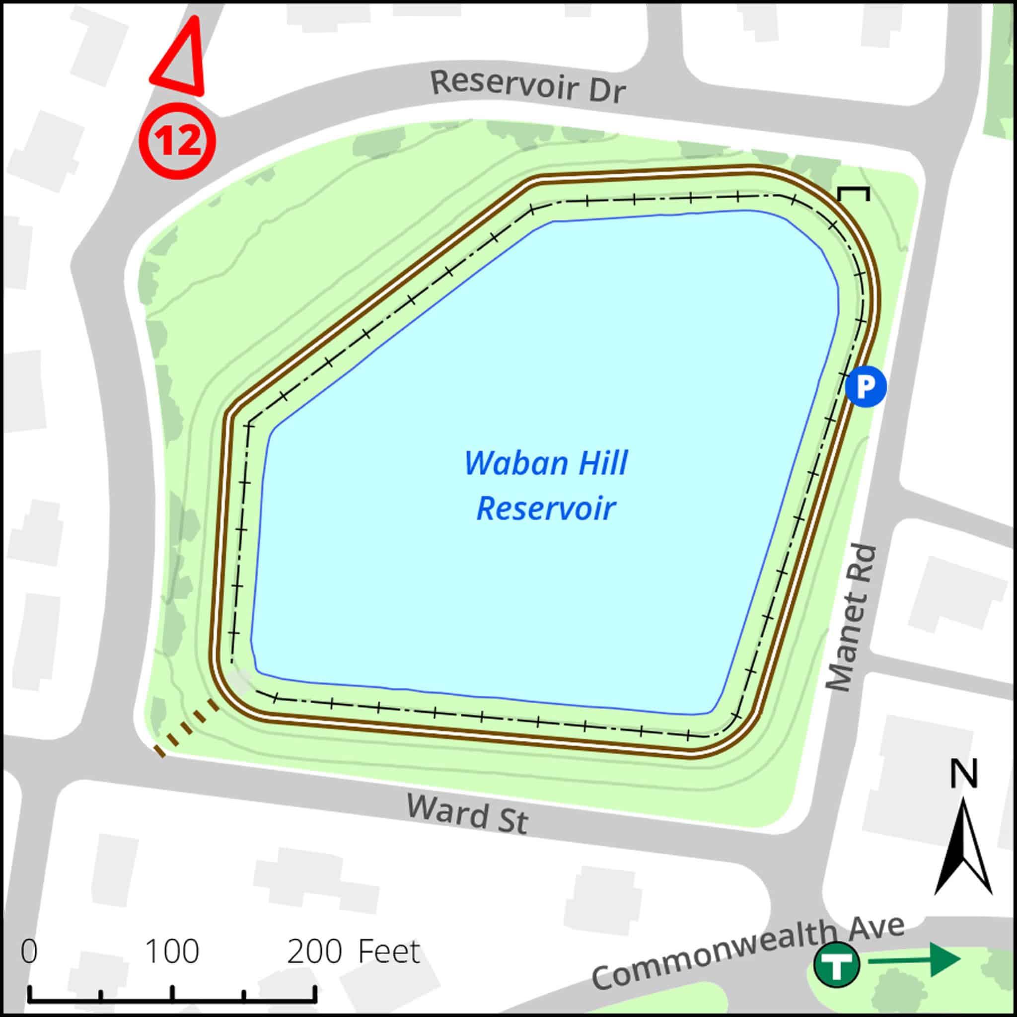
Click map for larger image •
Owner & Administrator Websites
Newton Conservators (conservation restriction holder)
Friends of Heartbreak Hill Park at Waban Hill Reservoir
Photo Gallery


First three photos shown here. Click a photo to view the complete slideshow or click here to browse the complete gallery.
History
1875
City of Newton purchased the site and began construction of the reservoir.
1900
City sold the reservoir to the Boston Metropolitan Water Board (predecessor of the Massachusetts Water Resources Authority–MWRA).
2013
The MWRA declared the reservoir to be surplus. The site was offered to the City of Newton for purchase at a price that did not reflect the development potential of the land, provided that the City would dedicate the land as open space.
2015
Acquired by City of Newton using CPA funds, subject to conservation restriction held by Newton Conservators
Features
Biking: Prohibited, Dogs On Leash, Generally Accessible Trail, Historic Site, MBTA Green Line, River/Lake/Pond, Scenic View
Additional Information
Newton Assessor’s Map ID: 63007 0001
Friends of Heartbreak Hill Park at Waban Hill Reservoir
History of the Waban Hill Reservoir
The Newton Community Preservation Program website has extensive information about the project.
Parks and Recreation Department head Robert DeRubeis described the project in the Conservators Spring 2015 Newsletter.
Newton Tab article: City takes back ownership of Waban Hill Reservoir (11/23/15)
Report a Problem
Report a Problem in a Newton City Park